

Winter Weather Expected
By Sam Poe
Sunday, February 9, 2014 | 8:02 PM
https://hbtv.us/news/?story_id=1965
 |
 |
Here's the latest update from the National Weather Service in Birmingham regarding the impending winter weather that will be in the area early this week.
We've got a complex winter weather event shaping up for central Alabama during the Monday through Thursday time frame. Here are the key points, as of 7:45 pm Sunday evening:
* Monday's weather will be fine through at least 3 pm for the vast majority of central Alabama. Folks up around Hamilton and Haleyville may want to check the latest radar loops early in the morning, as there may be a few spots of very light freezing rain. Otherwise, temperatures will be above freezing into the afternoon hours.
* After 3 pm, temperatures will start to drop right about the same time precipitation starts to invade the area. We think the bulk of the precipitation will not arrive until after 6 or 8 pm. However, there's always a chance that some patchy stuff could come in earlier.
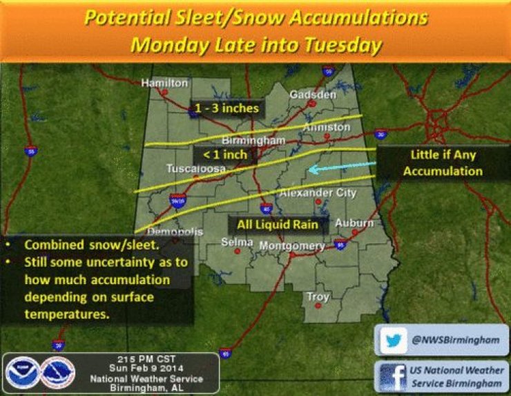
* Here's where the tricky part of the forecast comes. Conditions will become increasingly cold and increasingly wet as we transition into Monday night, especially after midnight. The farther north you are, the more likely you are to experience snow. The farther south you are, the more likely you are to experience a cold rain. In between, anything is possible, including sleet and freezing rain.
* Unfortunately, it looks like that potentially icy transition zone between the snow and the rain will cut right across north central Alabama. Based on all the latest computer model data, the cities of Tuscaloosa, Birmingham, and Anniston, and all areas within about 50 miles of those cities will potentially be in that transition zone at some point between midnight and noon on Tuesday.
* There's a chance this could turn into a prolonged winter weather event, as recent computer model runs indicate another disturbance could bring a second round of precipitation to the state Tuesday night and into Wednesday.
* Very small variations in temperatures (which are difficult to model) could lead to significant differences in precipitation type. Boundaries between snow, sleet, freezing rain, and rain areas rarely follow straight lines or gentle curves (even though that's frequently how there are depicted on forecasts).
* A Winter Storm Watch has been posted for areas we currently think stand the best chance of getting significant accumulations of snow and/or ice (see the previous two posts).
IMPACTS:
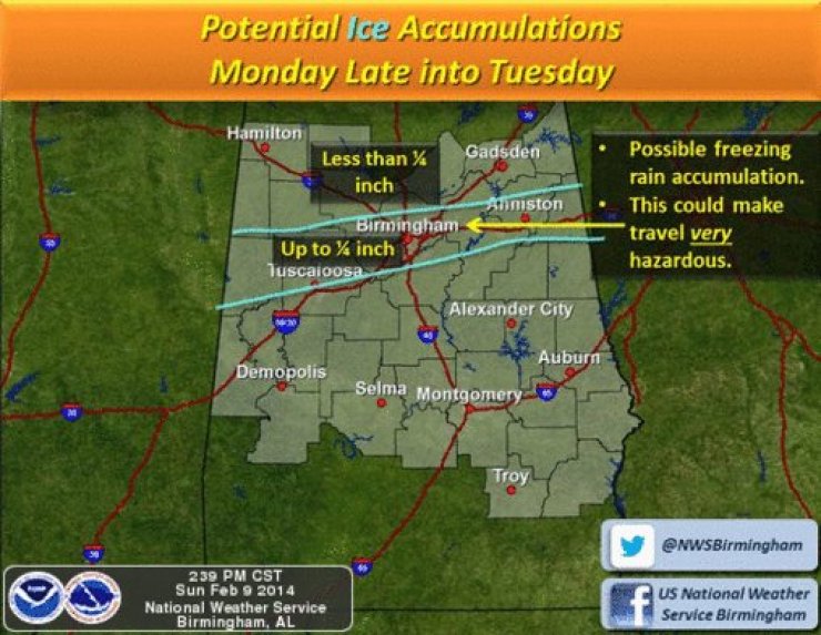
* Driving conditions could become quite hazardous Monday night into early Tuesday, especially in areas that receive heavier snow or freezing rain.
* With the threat of freezing rain, there is a chance that some spots may lose power as trees and power lines accumulate ice.
Photos and information is courtesy of the National Weather Service in Birmingham.