| |
by K. Bryan Ward
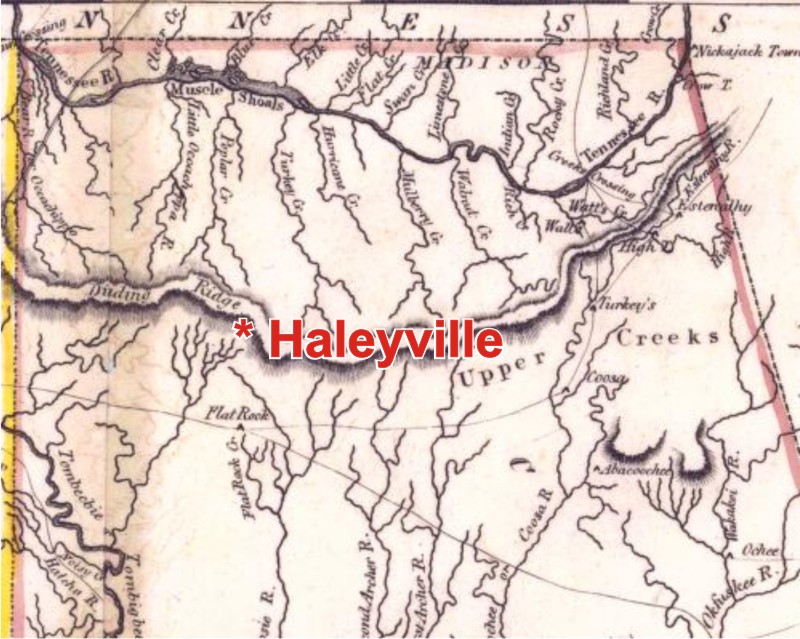
Many residents of Haleyville are probably familiar with the historic Byler Road located in downtown Haleyville. However, residents may not know that Haleyville was built on another travel route that was used for centuries before the first settlers entered Alabama.
|
This 1,000 mile trail, known as the “High Town Path” extends from Charlestown, South Carolina eastward through Georgia, Alabama and Mississippi. It ends at the Chickasaw Bluffs in Memphis, Tennessee. In Alabama, the High Town Path runs along the continental divide through the counties of Cleburne, Calhoun, Cherokee, DeKalb, Etowah, Blount, Marshall, Cullman, Morgan, Lawrence, Winston, Marion and Franklin. Native Americans made the trail on the mountain ridges of this continental divide in order to avoid creek crossings and lowland marshes. The High Town Path runs through Haleyville because the city is located on the same continental divide. It is interesting to note that because of this natural divide, creeks located north of Haleyville flow northward toward the Tennessee River and creeks south of Haleyville flow southward toward the Tombigbee River. |
The High Town Path was named after a Cherokee village called “High Town” which was located near present day Rome, Georgia. White settlers understood the Creek and Cherokee Indians to call this site “high tower” from the word “itawa.” Itawa most likely referred to the Etowah Indian Mounds that were located near the Cherokee village. These mounds, built around 950 A.D., can still be visited today.
Before the settlers came to Alabama, the Cherokee, Chickasaw and Creek Indians used the path to mark tribal boundaries. After the settlers arrived, the path became an important hunting and trading route. It has even been reported that Davy Crockett traveled on the High Town Path during the time of the Creek Indian War in 1812. In 1816, the High Town Path was used to mark the southern boundary for the lands ceded by the Cherokee and Chickasaw Nations. This was the result of the Turkey Town Treaty of 1816. It was called the Turkey Town Treaty because it was ratified at Turkey Town which was located northeast of present day Gadsden, Alabama. The members who signed the Turkey Town Treaty included Gen. Andrew Jackson, Gen. Merriweather and 22 Indian chiefs. Haleyville is located on part of the land that was ceded in the Turkey Town Treaty.
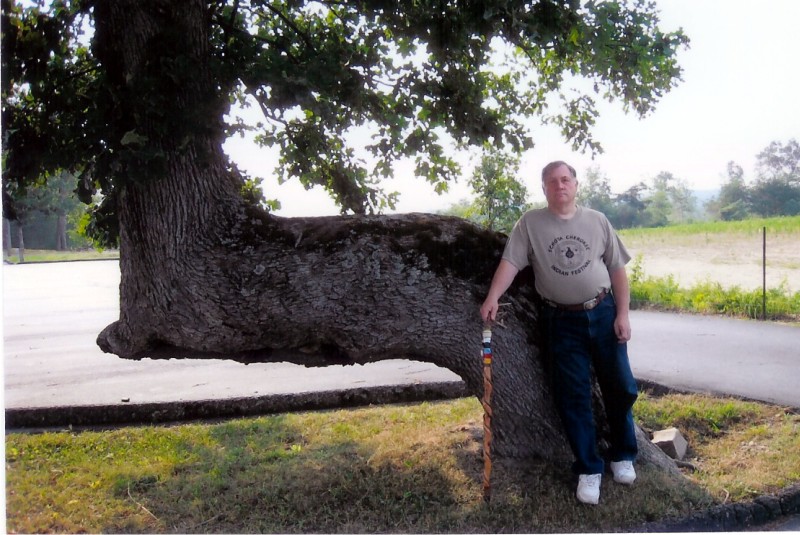
Today, there is still evidence of the ancient trail. Hikers can still explore parts of the trail located in the Bankhead Forest. Additionally, people who live near the High Town Path often discover some of the old “marker trees” that were made by the Indians. These “L” or “goal post” shaped trees were notched or fashioned so that the trunk would point toward the trail. Many of these unusual marker trees still survive in Haleyville today.
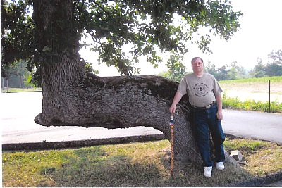 Kenneth Ward standing beside one of the
marker trees located near Haleyville (
Click to Enlarge Image ) |
A few years ago, a state resolution recognized the High Town Path as the most famous east – west Indian trail and tribal boundary in the Southeastern United States. Since then, signs have been placed in various places to mark the trail’s location. One of these signs is located near the intersection of Highway 5 and 195. |